Tag: maps
-
PUBLIC ASSEMBLIES & INFRASTRUCTURES
PUBLIC(S) ASSEMBLIES AND INFRASTRUCTURES is a third year architecture studio (Fall 2018) that will consider what and who constitutes the publics (in plural) of the cities of College Station and Bryan, in Texas, and how their identification and critical analysis can inform the production of a program and a project for architecture in the form of a public infrastructure or a public assembly. The studio will have a strong research agenda investigating subjects, communities, legal frameworks, technology, and contemporary forms of work and leisure that are informed by or resist the neoliberal logic of economical performance metrics. Finn Rotana Maclane…
-
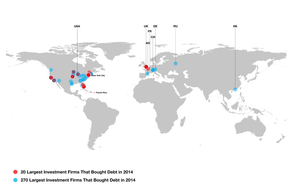
SPATIALIZING DEBT: A VISUAL AUDIT
Spatializing Debt: A Visual Auditing examines the intersection of architecture, political economy and visual imaginaries with the logics of state-financial debt under Puerto Rico’s current status, by giving territorial, spatial, and visual dimension to the so-called public debt. Investment Firms Information by the Centro de Periodismo Investigativo of Puerto Rico. Researcher, ongoing, 2017.
-

SPATIAL CONSTRUCTIONS
Spatial Construction: Occupying a Grid is an exercise for the Introduction to Architecture and Visual Culture studio for non-majors at Barnard and Columbia. It is focused on the better understanding of space within a set of given parameters. First, it will work around a virtual cubic structure (12″x12″)that will contain a formal grid. This will define one “spatial” and “formal” boundary to be enhanced, explored, challenged or disrupted. Second, following your home-to-studio-trip record and experience, you will elaborate a spatial construction based –but not limited to– your trip. Studio Instructor, 2015-16.
-

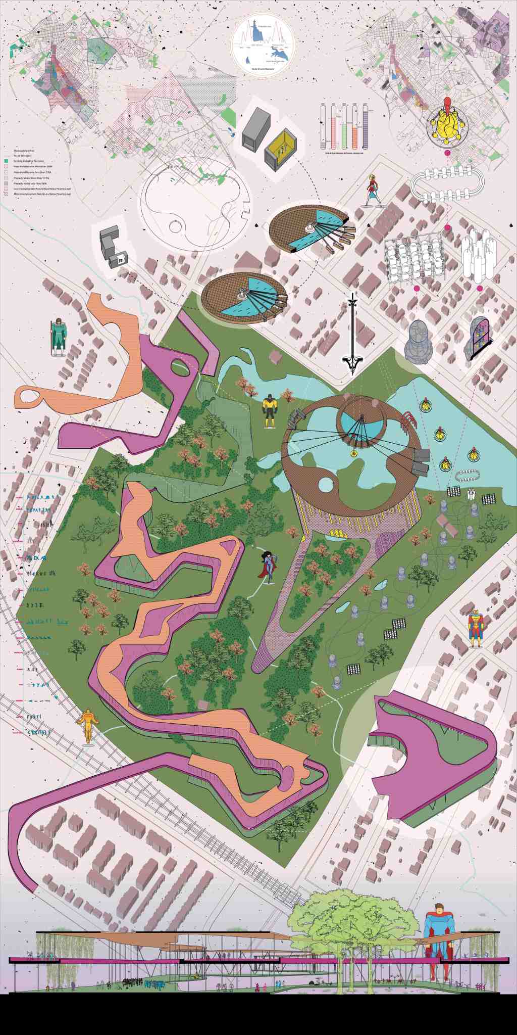
THE DAY AFTER THE CARNIVAL
The Day After the Carnival: The Hangover of Work (in Late Capitalism) was a graduate studio taught at Penn Design in the University of Pennsylvania, inquiring the intersection of work-production as a mode of carnivalesque action in the form of hangover. Students researched and draw existing program-buildings near Northern Liberties, analyzed their local-global logics, composed programmatic drawings, developed strategies and formulated and architectural assembly combining them all, including a large cultural programming. Studio Instructor, 2016.
-
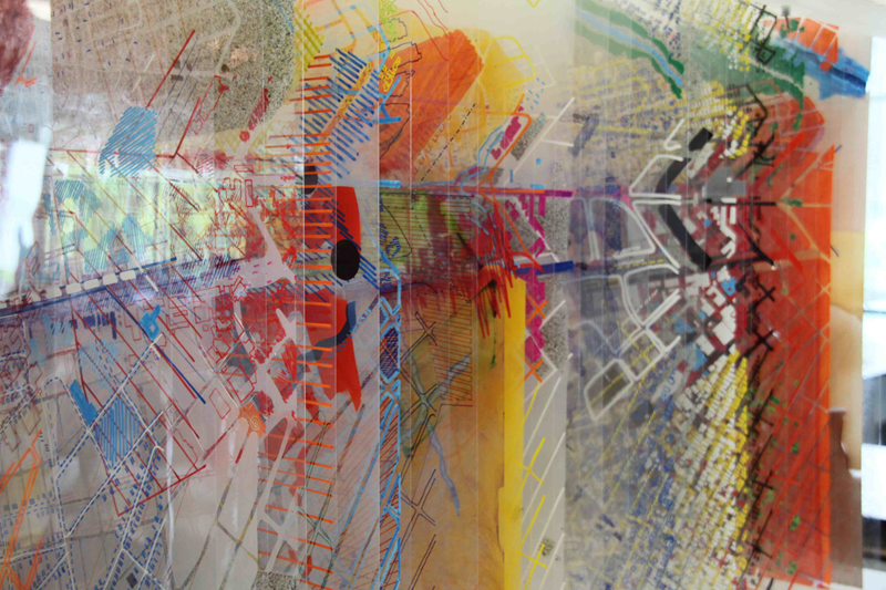
PLACE AND CONTEXT STUDIO
For the initial part of the course, first year undergraduate students where confronted to notions of place and context. An analytical city study was developed through the layering of cartographic drawings including a vast variety of the city’s visible and invisible infrastructure. Mixed media, hand drawn. Studio Instructor, 2007.
